


 Africana55 Radio

This website uses cookies so that we can provide you with the best user experience possible. Cookie information is stored in your browser and performs functions such as recognising you when you return to our website and helping our team to understand which sections of the website you find most interesting and useful.
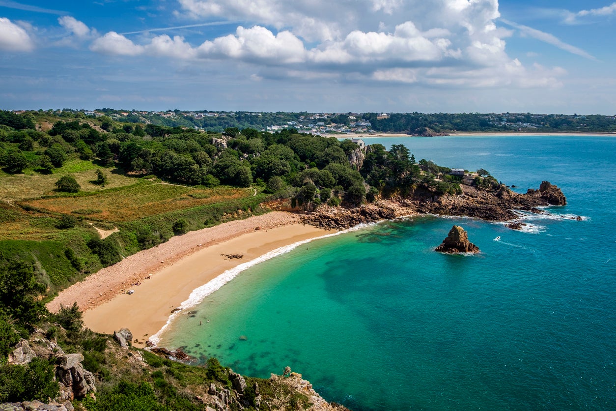
Tourists will be able to return to Jersey from Friday 3 July, after senators on the Channel Island voted to open its borders to unrestricted travel.
But visitors face a rigorous procedure in order to enjoy the island, which is currently believed to have no active cases of coronavirus.
Arriving travellers will have to register their travel plans in advance, with the Jersey government warning: “Anyone who fails to pre-register can expect to face significant delays when arriving in the Island.”
On arrival, the visitor will expected to produce proof of a negative test for coronavirus, taken within the past 72 hours of arriving in Jersey.
The alternative is to be swab-tested at the airport or harbour.
In this case the incoming traveller will be expected to “limit the time spent away from your accommodation, limit social contact and, where possible, avoid public transport and indoor gatherings”.
Travellers who decline to take a test will be expected to self-isolate for two weeks.
The chief minister, John Le Fondré, said: “We are in a very good place now, with no known active cases, and we want to protect that situation as far as possible.
“But we must also enable our valued hospitality businesses to get back to work, employ people and provide the services that can be enjoyed by both Islanders and visitors.
“I understand the genuine concern among some islanders. I want to reassure them that we have a robust system in place.”
If the test result is negative, the arriving traveller will be texted with the result and can continue as normal, providing they follow public health advice.
In the event of a positive test, the island’s contact tracing team will insist on 14 days of self-isolation at a government-run location, and trace recent contacts.
“If passengers wish to take part in the testing programme, they must take part in all aspects of it,” the Jersey government warns.
"Any failure to adhere to the full programme will result in a penalty fine of up to £1,000.”
Created with Sketch.
Created with Sketch.
1/8 Ben Macdui, Cairngorms National Park
Swap busy Ben Nevis for the scarcely-smaller Ben Macdui, Scotland’s second highest peak at 4,295ft, and scale CairnGorm – which ranks sixth – for good measure. Twelve miles long and likely to take eight to nine hours, a rollercoaster of a hike bagging both begins from the Cairngorm Ski Centre car park. You’ll shadow a run down Cairn Gorm, cross heathery moors and flank the small Coire an Lochain water (walkhighlands.co.uk).
Getty Images/iStockphoto
2/8 Sandwood Bay Loop, Sutherland
One of Britain’s great beaches, Sandwood Bay’s wind-blasted white sand is inaccessible by road; you must walk a four-mile track from Blairmore – in remotest northwestern Scotland – past small lochs. Its lagoon, supposedly-haunted bothy, crashing waves and spindly sea stack look even better from above. So zigzag up the southern cliff before taking the faint coast path and then crossing bumpy, boggy peat moorland back to the main track (ramblers.org.uk).
Getty Images/iStockphoto
3/8 Bochlwyd Horseshoe, Snowdonia
Snowdon is Wales’ most famous bluff, but nearby Tryfan is more eye-catching thanks to a shark-fin shape. It forms part of the Bochlwyd Horseshoe, which involves much scrambling over scree fields and – due to some wispy ridges – a head for heights. Veteran hikers are rewarded with scintillating, panoramic Snowdonia vistas and photo-ops on the overhanging Cantilever stone. The slow-going route is only eight miles, but will feel longer (mudandroutes.com).
Getty/iStock
4/8 Scafell Pike via Corridor Route, Lake District
The ways up England’s highest mountain vary in popularity. Leaving the Lakeland hordes to follow an easy path from Wasdale, use instead the Corridor Route to steeply approach Scafell Pike’s quieter north side. After attaining its boulder-strewn, 3,209ft summit, loop back to start-point Seathwaite via burly Broad Crag. Almost ten miles long, this tough circular promises riversides, ravines, a waterfall and four Hewitts – hills over 2,000 feet (mudandroutes.com).
Getty Images for PCA
5/8 Slieve Binnian Trail, County Down
A challenging circular through Northern Ireland’s Mourne Mountains which starts off gently before plunging up alongside the attractive Mourne Wall: an early 20th-century dry-stone dyke built to separate cattle from a reservoir below. Though some scrambling is required to reach Slieve Binnian’s 2,449-foot crest, its views – to the Isle of Man on clear days – easily merit the effort, as does a diverse descent past the Blue Lough and Annalong Wood (walkni.com).
Getty Images/iStockphoto
6/8 Byrness to Kirk Yetholm, Northumberland, Scottish Borders
It can take 16 days to complete the 268-mile Pennine Way, but if you only have one to spare then combine the last (and usually least-crowded, due to a lack of accommodation) two stages for a real wilderness walk. Traversing the wild Cheviot Hills and hugging the Scottish border, it’s a lonely 27-mile trudge characterised by bog-hopping boardwalks and slab paths (nationaltrail.co.uk/pennine-way).
Getty Images/iStockphoto
7/8 The Broomway, Essex
It’s only six miles long, yet the Broomway is reckoned to have killed 100 people. From Great Wakering, it heads straight out to sea at low tide, eventually reaching the marshy island of Foulness. Why so perilous? Because the path is mostly unmarked, the tide returns faster than humans can and there is a lot of quicksand on the route. But in good weather, and traversed safely, this can be one of the most bracing beach walks Britain has on offer (broomway.org.uk).
Getty
8/8 Yorkshire Three Peaks
What do Pen y Ghent, Whernside and Ingleborough have in common? Well, they’re Yorkshire’s highest mountains, they each offer fine views and all three are surmountable during a gruelling 24-mile trek. Along with over 5,000 feet worth of ascent, you’re promised the Ribblehead viaduct, picturesque Dales High Way sections and, of interest to geologists, distinct limestone-gritstone overlaps. Begin and end at Horton in Ribblesdale, where pubs are happily on standby (threepeakschallenge.uk).
Getty Images/iStockphoto
1/8 Ben Macdui, Cairngorms National Park
Swap busy Ben Nevis for the scarcely-smaller Ben Macdui, Scotland’s second highest peak at 4,295ft, and scale CairnGorm – which ranks sixth – for good measure. Twelve miles long and likely to take eight to nine hours, a rollercoaster of a hike bagging both begins from the Cairngorm Ski Centre car park. You’ll shadow a run down Cairn Gorm, cross heathery moors and flank the small Coire an Lochain water (walkhighlands.co.uk).
Getty Images/iStockphoto
2/8 Sandwood Bay Loop, Sutherland
One of Britain’s great beaches, Sandwood Bay’s wind-blasted white sand is inaccessible by road; you must walk a four-mile track from Blairmore – in remotest northwestern Scotland – past small lochs. Its lagoon, supposedly-haunted bothy, crashing waves and spindly sea stack look even better from above. So zigzag up the southern cliff before taking the faint coast path and then crossing bumpy, boggy peat moorland back to the main track (ramblers.org.uk).
Getty Images/iStockphoto
3/8 Bochlwyd Horseshoe, Snowdonia
Snowdon is Wales’ most famous bluff, but nearby Tryfan is more eye-catching thanks to a shark-fin shape. It forms part of the Bochlwyd Horseshoe, which involves much scrambling over scree fields and – due to some wispy ridges – a head for heights. Veteran hikers are rewarded with scintillating, panoramic Snowdonia vistas and photo-ops on the overhanging Cantilever stone. The slow-going route is only eight miles, but will feel longer (mudandroutes.com).
Getty/iStock
4/8 Scafell Pike via Corridor Route, Lake District
The ways up England’s highest mountain vary in popularity. Leaving the Lakeland hordes to follow an easy path from Wasdale, use instead the Corridor Route to steeply approach Scafell Pike’s quieter north side. After attaining its boulder-strewn, 3,209ft summit, loop back to start-point Seathwaite via burly Broad Crag. Almost ten miles long, this tough circular promises riversides, ravines, a waterfall and four Hewitts – hills over 2,000 feet (mudandroutes.com).
Getty Images for PCA
5/8 Slieve Binnian Trail, County Down
A challenging circular through Northern Ireland’s Mourne Mountains which starts off gently before plunging up alongside the attractive Mourne Wall: an early 20th-century dry-stone dyke built to separate cattle from a reservoir below. Though some scrambling is required to reach Slieve Binnian’s 2,449-foot crest, its views – to the Isle of Man on clear days – easily merit the effort, as does a diverse descent past the Blue Lough and Annalong Wood (walkni.com).
Getty Images/iStockphoto
6/8 Byrness to Kirk Yetholm, Northumberland, Scottish Borders
It can take 16 days to complete the 268-mile Pennine Way, but if you only have one to spare then combine the last (and usually least-crowded, due to a lack of accommodation) two stages for a real wilderness walk. Traversing the wild Cheviot Hills and hugging the Scottish border, it’s a lonely 27-mile trudge characterised by bog-hopping boardwalks and slab paths (nationaltrail.co.uk/pennine-way).
Getty Images/iStockphoto
7/8 The Broomway, Essex
It’s only six miles long, yet the Broomway is reckoned to have killed 100 people. From Great Wakering, it heads straight out to sea at low tide, eventually reaching the marshy island of Foulness. Why so perilous? Because the path is mostly unmarked, the tide returns faster than humans can and there is a lot of quicksand on the route. But in good weather, and traversed safely, this can be one of the most bracing beach walks Britain has on offer (broomway.org.uk).
Getty
8/8 Yorkshire Three Peaks
What do Pen y Ghent, Whernside and Ingleborough have in common? Well, they’re Yorkshire’s highest mountains, they each offer fine views and all three are surmountable during a gruelling 24-mile trek. Along with over 5,000 feet worth of ascent, you’re promised the Ribblehead viaduct, picturesque Dales High Way sections and, of interest to geologists, distinct limestone-gritstone overlaps. Begin and end at Horton in Ribblesdale, where pubs are happily on standby (threepeakschallenge.uk).
Getty Images/iStockphoto
The border testing scheme has been in place since 1 June. Until now incoming travellers were expected to be tested again four and seven days after arrival.
Jersey has recorded 319 cases of Covid-19, with 31 deaths.
Flights to the island are resuming at scale on British Airways, easyJet and Blue Islands. The main carrier, Flybe – formerly known as Jersey European – went out of business at the start of the coronavirus crisis.